
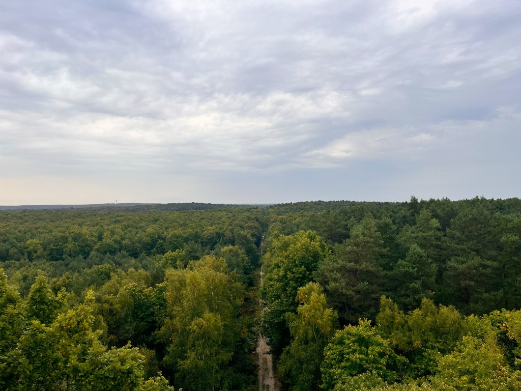
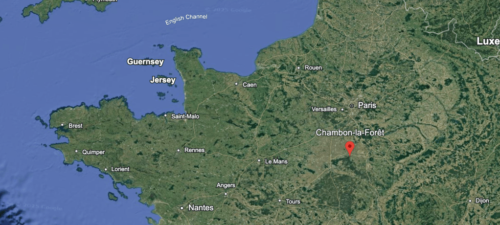
The largest forêt domaniale in France is the Forêt d’Orléans, and I’m lucky to have a personal connection to it for more than two years now. At its edge, in the middle of the vast plains of the northern edge of central France, lies a small town of 900 inhabitants called Chambon-la-Forêt, in the Loiret department, and approximately 2 hours by car from Paris. It is a precious place.
I have been visiting this beautiful and quiet town several times a year to visit my partner’s family, and it fascinates me in ways I still find hard to understand. Having grown up in a city of more than one million people in Latin America, and after living in several large cities, it has obviously a very different rhythm and lifestyle than what I am used to.
But there is also something more to it, a sense of mystery and discovery in these visits that I have never found elsewhere. I think that discovering so many layers and so much complexity in a town of 900 inhabitants has put in check my assumptions about what makes a place interesting. I could even call it an existential transformation. Or am I just romanticizing small-town life, like people who come from the city often do? Archaeology outside, archaeology within.
But enough self-referential reflection.
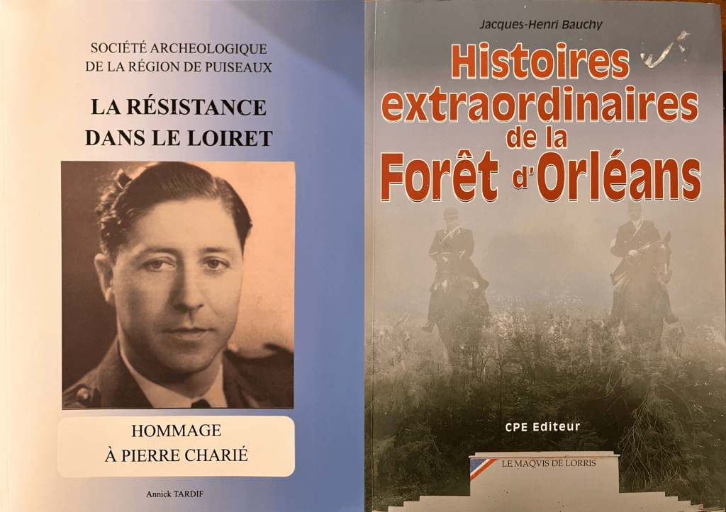
From my first visit, it was quite obvious that the town holds an incredible archaeological and historical heritage, and with each visit I’ve explored another layer of it (with the great support and patience of my partner and their family). The bourg, the lavoir, the medieval church, the Château de Luzerne, the St Radegonde spring, the building of La Rive du Bois, the maquis de Chambon in World War II…
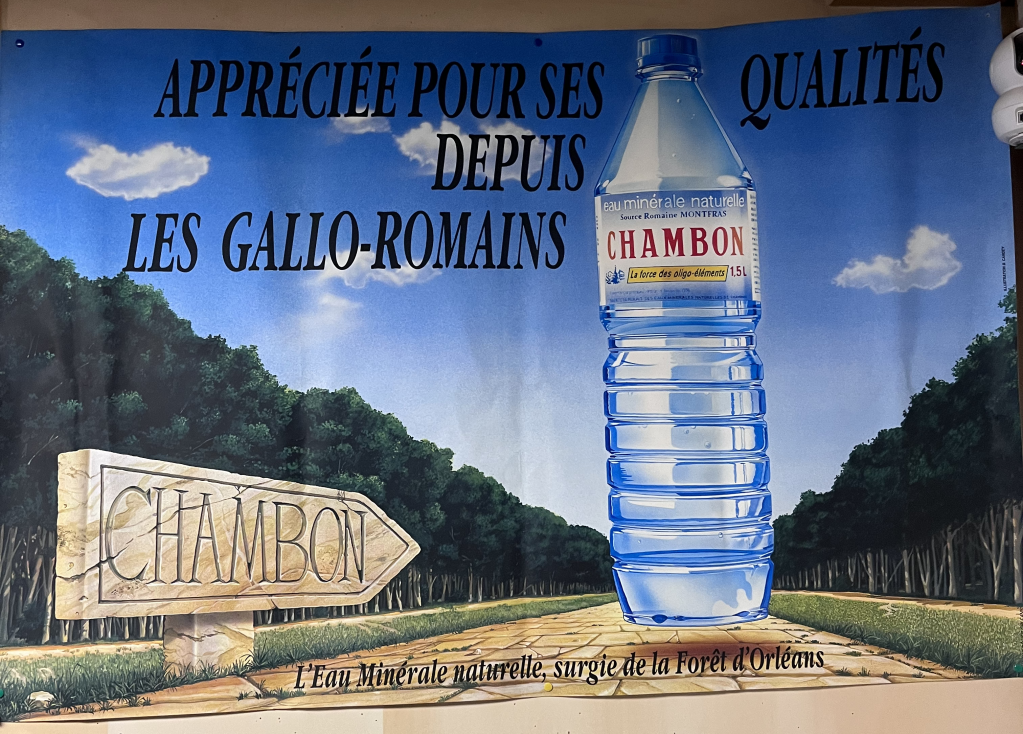
But there was a fascinating layer of its history that I was missing, as the history of Chambon goes much further back than the Middle Ages. Although I had seen the ads for the mineral water spring advertised as “exploited since the Romans,” the reality is that the Gallo-Roman past of the town is less evident (or documented) than more recent aspects of its history.
By chance I came across this piece of the history of Chambon and fell down a rabbit hole that took me to one of the most important moments of Roman history, the Gallic Wars, some very mysterious burial mounds, and a ton of other fascinating stories.
A research rabbit hole
It all started with the Itinir-E project, a fascinating digital atlas of ancient roman roads developed by professors from Aarhus University and the Universitat Autònoma de Barcelona. I had seen some news about it, but hadn’t spent much time exploring it. When my partner shared it with me again (with the warning that it would probably take up quite a lot of my time), I decided to give it a much closer look (he was right).
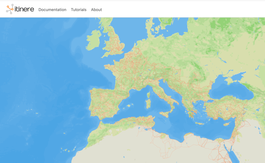
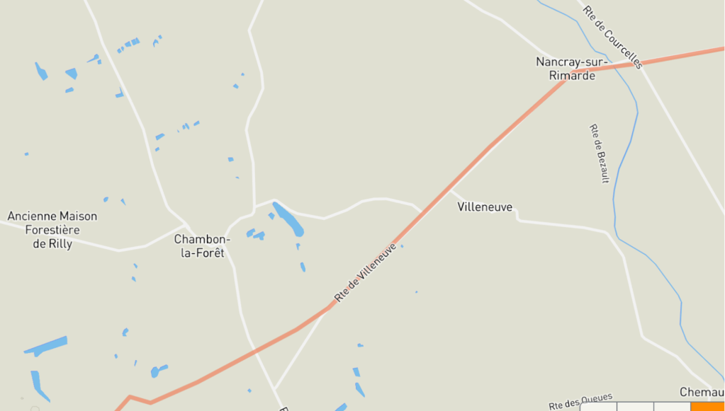
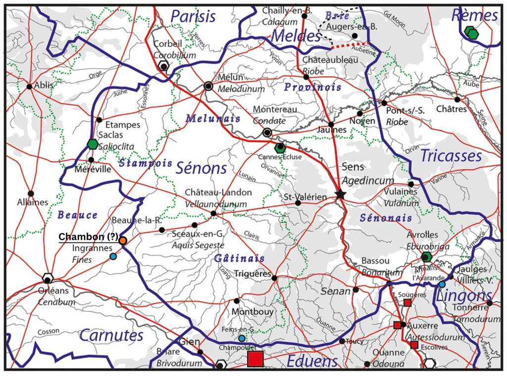
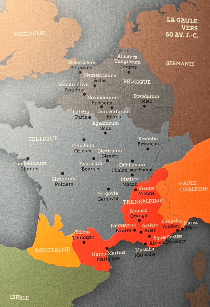
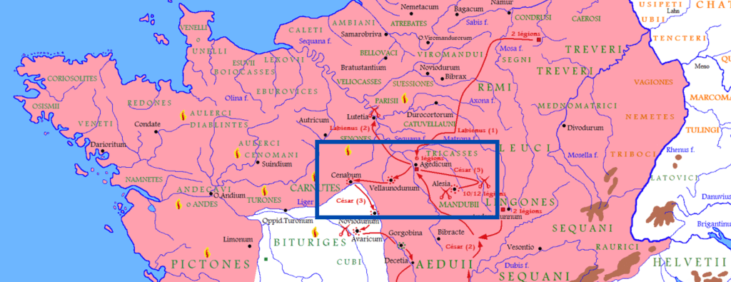
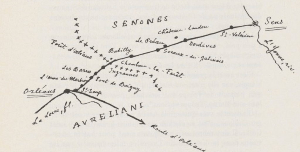
When I first looked up Chambon, I discovered that the Route of Caesar, an important road in Roman Gaul connecting Cenabum (Orléans) to Agendicum (Sens), passed very nearby.
My first thought (after asking my partner, “HOW COME YOU DIDN’T TELL ME THAT?”, to which he replied that he had no idea) was that there must have been a lot going on here in Gallo-Roman times, and probably long before that as well, in protohistory and beyond.
Step-by-step, different things came up pointing to a very old occupation of this site, and that I am slowly piecing together evidence from the archives, from talking with people in the area, and from visiting some of the sites.
So what exactly was happening in Chambon in gallo-roman times (and before)? Not an easy question to answer, I discovered.
As I started digging into the available material, several elements started coming up that attest to a very rich ancient history of the area:
- the presence of a voie romaine crossing the area – through where Caesar troops passed during one of the most important episodes of the Gallic wars! (more on that below)
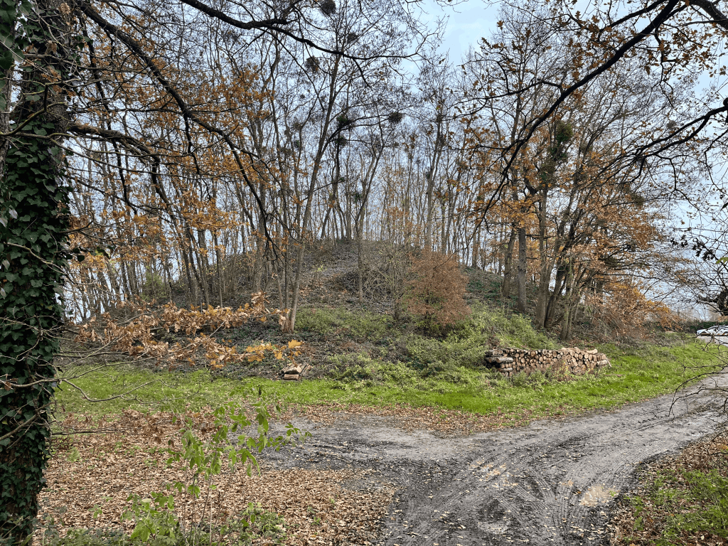
- two tumuli, fascinating and large burial mounds still shrouded in mystery;
- a natural spring and pilgrimage spot associated with Sainte Radegonde, as early as the 5th century. Its ritual use may point to an older sacred association with the spring, later “recycled” in Catholic practices.
- archaeological finds from surveys carried out by Patrick Baroni in the 2000s and 2010s, including the identification of a Roman pottery complex and the discovery of a menhir;
- the Source de Montfras, which suggests a very old, and probably mythical or symbolic, association with the place. Conversations with local residents also mention the discovery of a Roman mosaic and a Roman bath complex in the area, reportedly part of a broader archaeological collection from Chambon-la-Forêt allegedly housed in the Museum of Pithiviers, which is currently closed;
- multiple gallo-roman coin finds reported over the last two centuries, documented in Gallo-Roman catalogues and in the 19th-century archaeological bulletins of Orléans;
- local accounts mentioning findings of silex in the fields, attesting prehistoric activity;
- a large-scale excavation carried out in the 1970s at the nearby Sablière de Châtillon uncovered the remains of an extensive Gallo-Roman pottery complex, attesting to long-standing clay extraction in the area. This continuity is also evident in the fact that Chambon was home to one of the last traditional medieval brickworks in France, highlighting the importance of this economic activity, particularly in the Rive-du-Bois area.
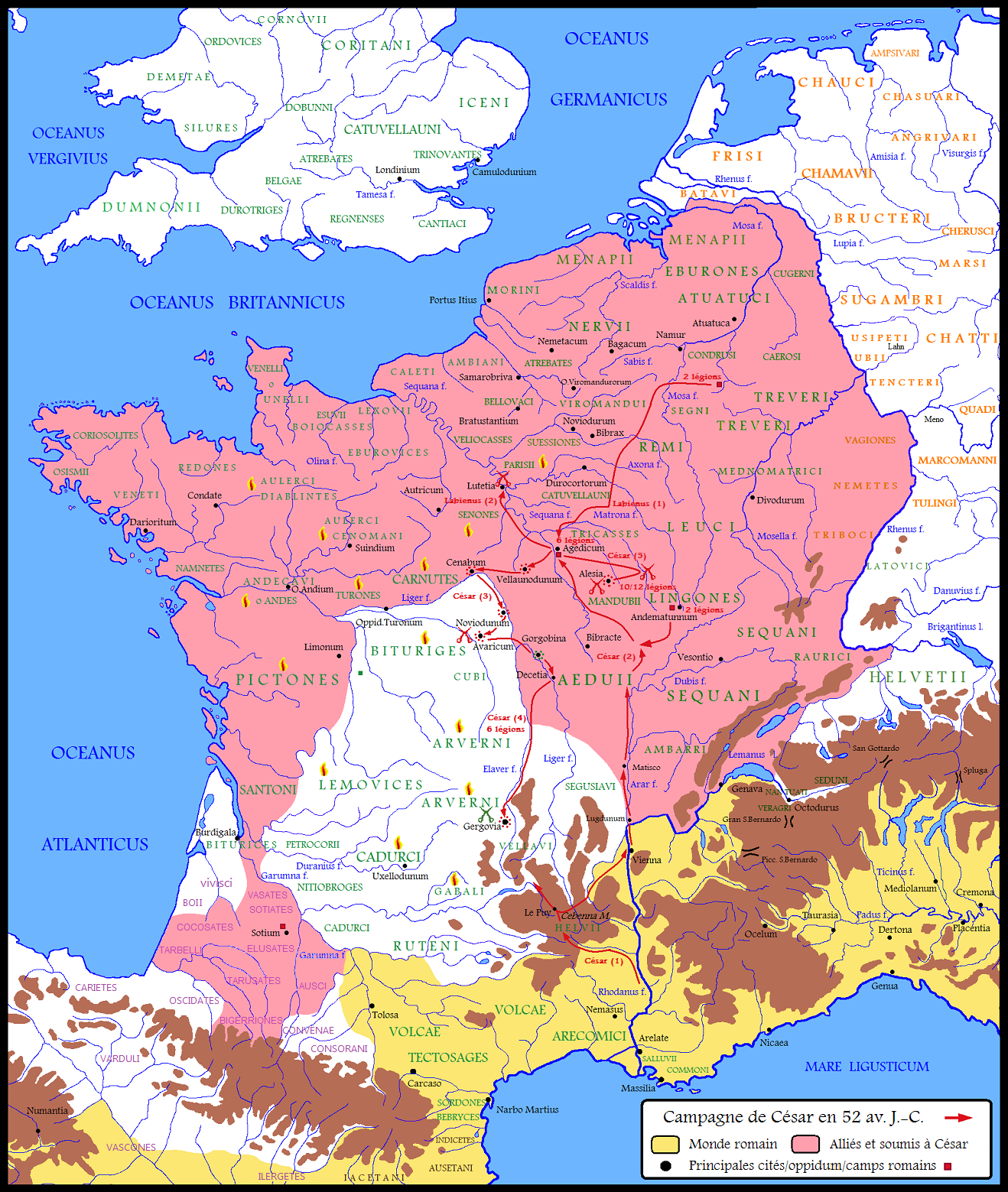
I ended up uncovering many leads and collected (and still collecting) a large amount of information on the different aspects of the area’s ancient history. But the first question I really wanted to answer, to make sense of all this evidence was: what exactly was happening in this region in antiquity? To my surprise, this led me to one of the most important texts of Western history, The Gallic Wars (De Bello Gallico), written by Julius Caesar in the 1st century BC.
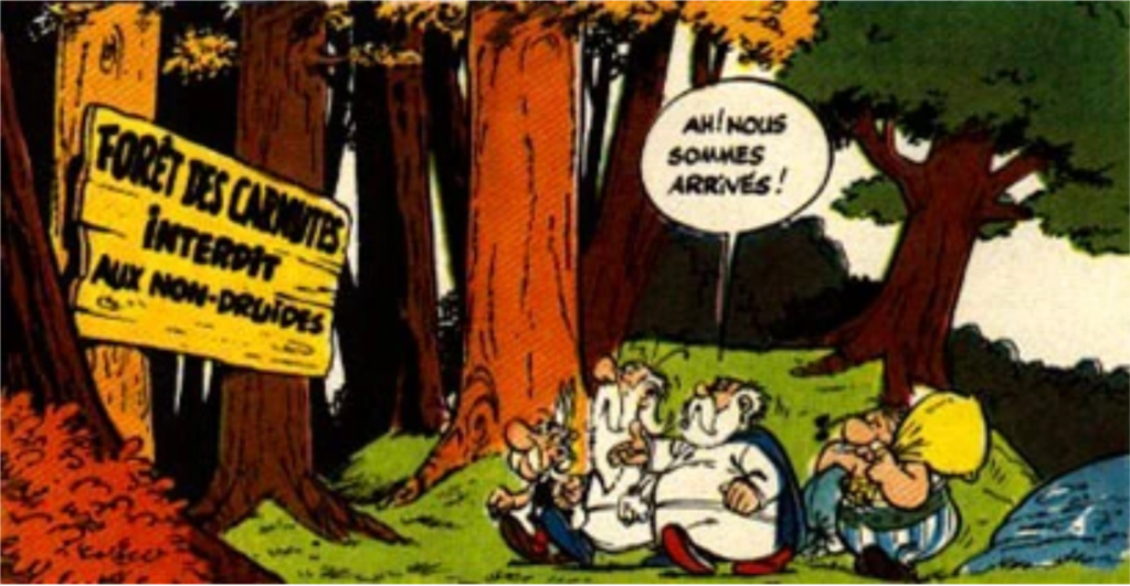
The Carnutes and the Senones
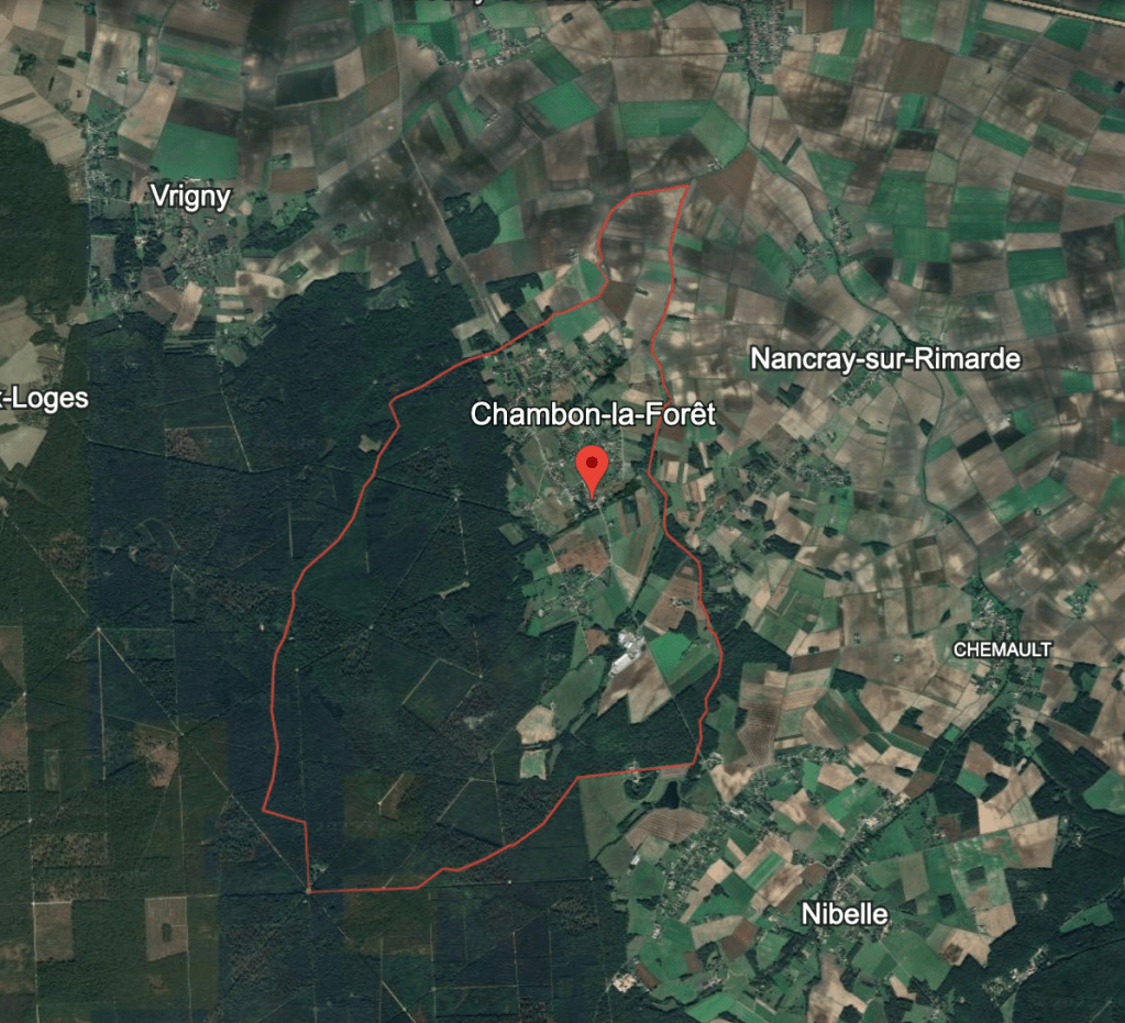
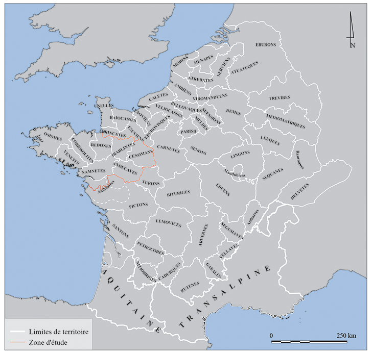
It happens that Chambon sits right at (or very close to) the border between the territory of two Gaulish tribes, the Carnutes (gaulish for “the horned ones”, around Cenabum, modern Orléans) and the Senones (gaulish for “the ancient ones”, around Agendicum, modern Sens). The Gauls were a collection of Celtic tribes occupying the territory of modern France until they were formally annexed by Rome after bloody raids.
Gaulish culture relied primarily on oral tradition and used writing only in specific contexts, especially administrative ones. In fact, the druids were prohibited of registering their wisdom in writing. As a result, most of what we know about the Gauls, including the Senones and the Carnutes, comes either from material culture or from the accounts of other peoples who made use of writing, notably the Greeks and the Romans.
The Senones appear relatively early in Roman historiography. In 390 BC, when Rome was a Republic beginning to assert itself in the region through expansionist ambitions, a group of Senones who had settled in the northern Italian peninsula famously sacked the city.
This episode, known as the First Sack of Rome, is attested through accounts written centuries later by several Roman and Greek authors (Livy, Polybius, Tacitus, among others), which raises questions about their accuracy. Some elements of the story appear partially mythical, and modern historiography generally agrees that there is little evidence to support the scale of destruction described in these texts, which most likely reflect localized Gaulish raids rather than a full-scale sack.
Regardless of how accurate the descriptions that reached us are, the sack of Rome by the Gauls became a Roman collective trauma, retold for generations. When Julius Caesar undertook his campaign to conquer Gaul between 58 and 50 BC, he was, in a sense, vindicating a centuries-old grudge. Most of the details of this campaign, and much of what we know about the Gauls, come directly from Caesar’s own account, the Commentarii de Bello Gallico.
Despite its horrific and violent subject matter, showing Roman imperialism at its “best” and “bureaucratized” way, I hold this book very close to my heart. It was the first original text I worked with when I took Latin 101 more than 15 years ago.
And in this campaign, the Carnutes and the Senones – the original inhabitants of the area of Chambon – played a significant role, notably by “conspiring” against Rome in the defense of their territory.
The Gauls resist
By 53 BC, Julius Caesar’s campaign in Gaul had already been underway for five years, and revolts were breaking out across the region. In Book VI of the Gallic Wars, Caesar recounts one such uprising: a coordinated conspiracy involving the Senones and the Carnutes, who had been acting together. Caesar responded by convening an assembly of Gaul at Durocortorum (Reims), where Acco, identified as one of the ringleaders, was condemned and executed according to Roman custom.
There is little doubt that the Carnutes and the Senones were not only neighbors, but also ready to take up arms together in the face of external threats.
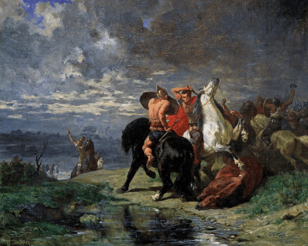
The following year, in 52 BC, the situation escalated dramatically. In the territory of the Carnutes, a wider and more coordinated resistance against Roman rule took shape. In Cenabum, modern Orléans, the Gauls killed Roman officials and merchants and plundered their property.
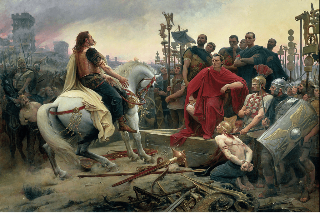
Under the leadership of the (now famous) Vercingetorix, the movement quickly spread across central Gaul, drawing in several peoples, including the Senones and the Parisii. This episode is often interpreted today as one of the most significant attempts at political unification among the ancient peoples living in the area of modern France. Vercingetorix has, to this day, remained a powerful figure in the French national imagination. Since the nineteenth century, he has been repeatedly used politically as the first “national” leader and as a symbol of unity and resistance, helping to construct an alleged continuity between modern France and ancient Gaul.

Rome responded violently to this movement, opening the most brutal phase of the Gallic Wars, which culminated in the defeat of Vercingetorix at Alesia. Gaul would then become a Roman province, and the territory where Chambon now sits would be incorporated into a Roman civitas.
However, as often in history, the picture is more complex than it appears. Strictly speaking, there was no such thing as “Gaul.” The term was a Roman construct, imposed on a mosaic of Celtic peoples living roughly in what is now France. In naming and delimiting Gallia, with the Rhine as its frontier, a region that he was working to “civilize”, Caesar also defined its opposite: on the other side of the river, the same Celts became “Germans,” cast as barbarians. In this sense, Gaul itself was, quite literally, a Roman invention.
Locus consacratus
There is another piece of information given by Caesar on the Carnutes that takes us (somewhat) close to Chambon.
Caesar refers in the book VI, that it was in the territory of the Carnutes was mentioned by Cesar as being the place of a sacred place, considered the centre of the whole of Gaul, where Druids would come once an year in a sort of assembly. This was the locus consacratus.
There is an idea repeated to this day that this place was situated inside a forest. The question is contentious and has been the object of discussions for the past centuries and still to this day. The sacred place of the druids has taken the imagination of several generations, and to this day its place A paper from 2018 (Krausz), the idea of a “sacred forest” may be more of a Romantic-era construction than a historical reality.
It’s known that the idea of divinity in the Gauls was closely related to specific places of significance to their agrapastoal world:
Les populations gauloises sont essentiellement agropastorales et la plupart de leurs dieux sont dites topiques. C’est-à-dire qu’ils sont intimement associés à des lieux, une source, une montagne, un endroit où la foudre est tombée… C’est por cela qu’il n’existe pas, pour ces périodes, de sanctuaires avec des statutes de dieux, pas de “temples”. Ces dieux, multiples, n’avaient pas apparence humaine.
Garcia. Les Gaulois. p. 149
That’s why a settlement so close to a forest, so close to a source – such as the case of Chambon – could have certainly had a specific significance in Gaulois imagery.
But the discussion continues
Chambon as the border?
This idea of Chambon as a border area is something that came up from more than one person whom I talked with in the city. One very interesting hypothesis also raised that the two tumuli were actually border markers more than. My visit to the tumuli will have to wait for another post.

Attention, traveller! You are now entering the territory of the Carnutes.
I tried to find some evidence for this border hypothesis in the historical work, and ended up in the meticulous work carried out Jacques Soyer, who worked as the archivist of the Loiret from 1904 to 1935, in documenting the history and archaeology of the region.
In the book Les voies antiques de l’Orléanais : civitas Aurelianorum, he argues very decisively argues that there is no doubt that the area of Chambon-la-Forêt marked the (natural) border between the Senones and the Carnutes:
Ingrannes était du diocèse d’Orléans, tandis qu’à l’est la paroisse voisine, Chambon-la-Forêt, était du diocèse de Sens. Il est hors de doute qu’à l’époque gauloise, c’est là qu’était la limite entre les Senones et les Carnutes, limite d’ailleurs naturelle, formée par le « rain² » oriental de la vaste forêt d’Orléans. Après la conquête et le démembrement de la civitas Carnutum, cette frontière de l’est ne subit aucune modification.
What is certain is that When we refer to Chambon as some sort of settlement at a border, this is certainly very different from our modern idea of what a border is (which is more linked to the idea of Nation-state, an idea quite modern and roughly the by-product of Westphalia in the XXth century).This border area, however, is certainly differently from our modern idea, Westphalian of a Nation-state with fixed borders. The limits between the Gaulish peoples were not linear borders, but buffer-frontiers and borderlands: mountains, plains, and, importantly in our case, or forests. [5]
This border area, however, must be understood very differently from our modern, Westphalian conception of the nation-state with fixed and clearly demarcated borders. The limits between Gaulish peoples were not linear frontiers, but broad zones of contact and separation, buffer-frontiers marked by landscape features such as mountains, plains, and, of course, forests.
In that perspective, the Forêt d’Orléans, or the Forêt des Carnutes, marked such a zone of separation, and Chambon could have been the first settlement a traveller would find after leaving this territory ; or the last before entering it, depending on the direction of travel through Caesar’s Road.
So what mysteries this former border gallo-roman station still hides? More to come.
References
- Bulletins de la Société archéologique et historique de l’Orléanais (1874 – 1947)
- Dominique Garcia. Les Gaulois. CNRS Éditions.
- Itiner-E Project. The Atlas of Ancient Roads. Aarhus University & Universitat Autònoma de Barcelona. [URL: https://itiner-e.org/].
- Julius Caesar. Commentarii de Bello Gallico (The Gallic Wars).
- Livy. Ab Urbe Condita Libri (History of Rome).
- National Geographic. “The First Sack of Rome.” [URL: https://www.nationalgeographic.com/premium/article/first-sack-of-rome-gaul].
- Patrick Baroni. Forêt d’Orléans [notice archéologique], ADLFI. Archéologie de la France – Informations [En ligne], Centre-Val de Loire, mis en ligne le 09 septembre 2020, consulté le 14 mars 2026. URL : http://journals.openedition.org/adlfi/37935
- Rémy, Julie. « Pour une étude des territoires du nord-ouest de la Gaule ». Territoires et réseaux en Bretagne et Pays de la Loire à la fin de l’âge de Fer (IIIe-Ier siècles a.C.), Ausonius Éditions, 2021, https://doi.org/10.4000/books.ausonius.19848.
- Sophie Krausz. Le locus consecratus des Carnutes. HAL Open Science. [Link: https://hal.science/hal-02447393].
- Soyer, Jacques. Les voies antiques de l’Orléanais : civitas Aurelianorum.

Leave a comment